Pakistan has unveiled a new political map of the country that includes Indian-controlled Kashmir, in a symbolic move that coincides with the one-year anniversary of India stripping the Muslim-majority region of its semi-autonomy.
Prime Minister Imran Khan, addressing the nation on August 4 alongside Foreign Minister Shah Mahmood Qureshi, said the new national map had been approved by the cabinet and will be the official map of Pakistan.
The new map marks the Himalayan region as “Indian illegally occupied" Jammu-Kashmir, clearly stating it is disputed territory awaiting final status to be decided by United Nations resolutions.
Khan said the Kashmiri people had a right of self-determination, but that this promise has not been honored by the international community.
“Pakistan has always thought that Kashmir should be a part of the country,” he said.
Many Kashmiris seek either a united independent Kashmir or union with Pakistan.
The map will be used in educational institutions all over the country.
India responded by calling the map “an exercise in political absurdity" that establishes “untenable claims” to Indian territory.
“These ridiculous assertions have neither legal validity nor international credibility. In fact, this new effort only confirms the reality of Pakistan’s obsession with territorial aggrandizement supported by cross-border terrorism,” India's Foreign Ministry said in a statement.
The status of Kashmir has been a key dispute between Pakistan and India since the two split in 1947 after British colonial rule. The nuclear-armed rivals each control part of Kashmir and have fought two wars over its status.
India accuses Pakistan of sending militants over their de facto Kashmir border to commit violence and of supporting rebels on the ground, charges that Islamabad denies.
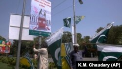
The unveiling of the new political map comes a day before anti-India protests are planned across Pakistan, along with a one-minute silence to mark New Delhi's move to revoke the special status of Indian-controlled Kashmir on August 5, 2019. Earlier, Pakistan named a highway in Islamabad after Srinagar, the major city in Indian-controlled Kashmir.
Indian Prime Minister Narendra Modi’s decision to change the status of Kashmir led to a weeks-long clampdown in the region and well-documented human rights abuses.
Indian and Pakistani soldiers have traded near-daily gunfire along the highly militarized line for more than a year, killing dozens of civilians and soldiers on both sides.